Postscript 2023 - Boots!

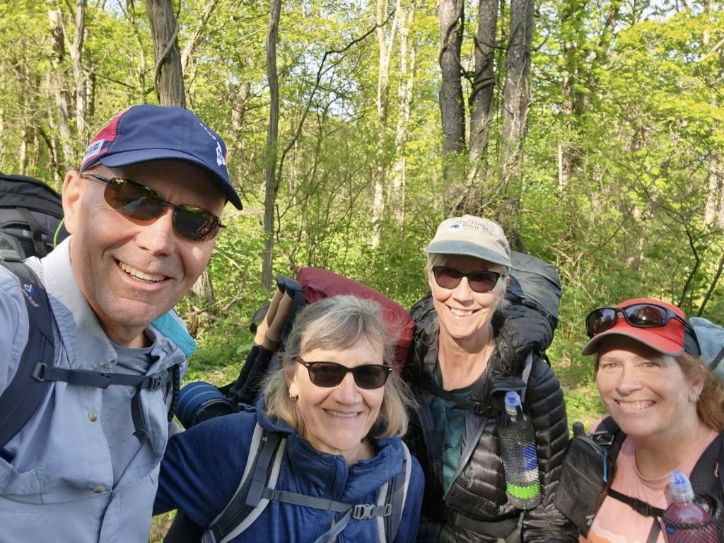
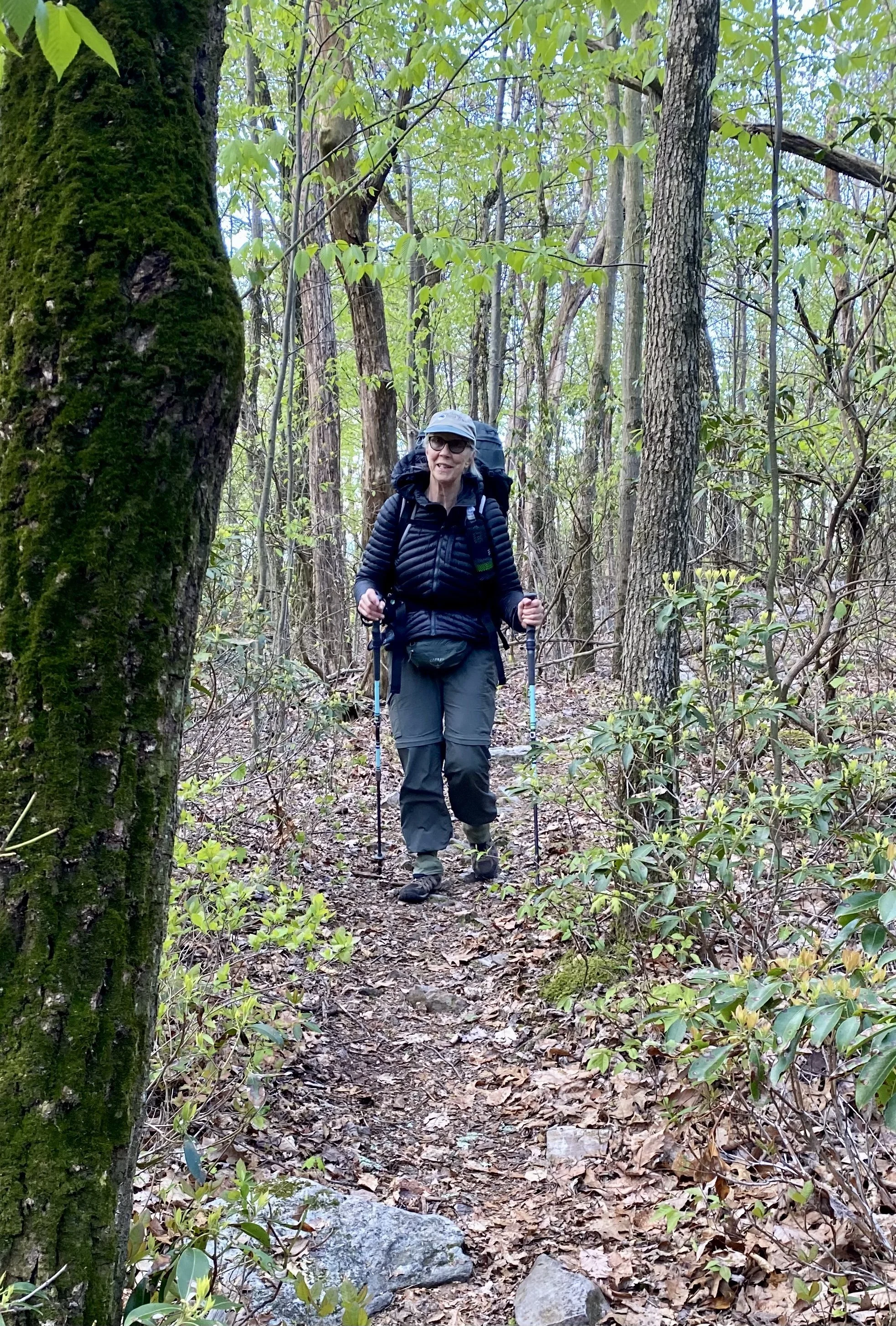
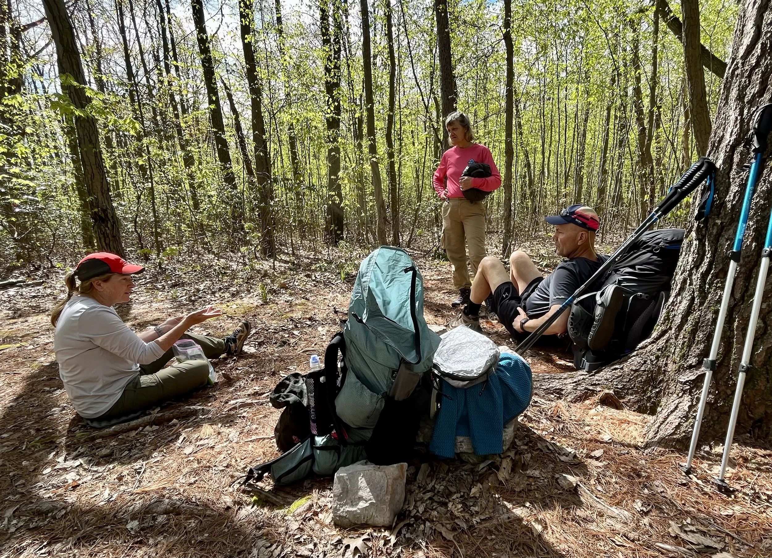
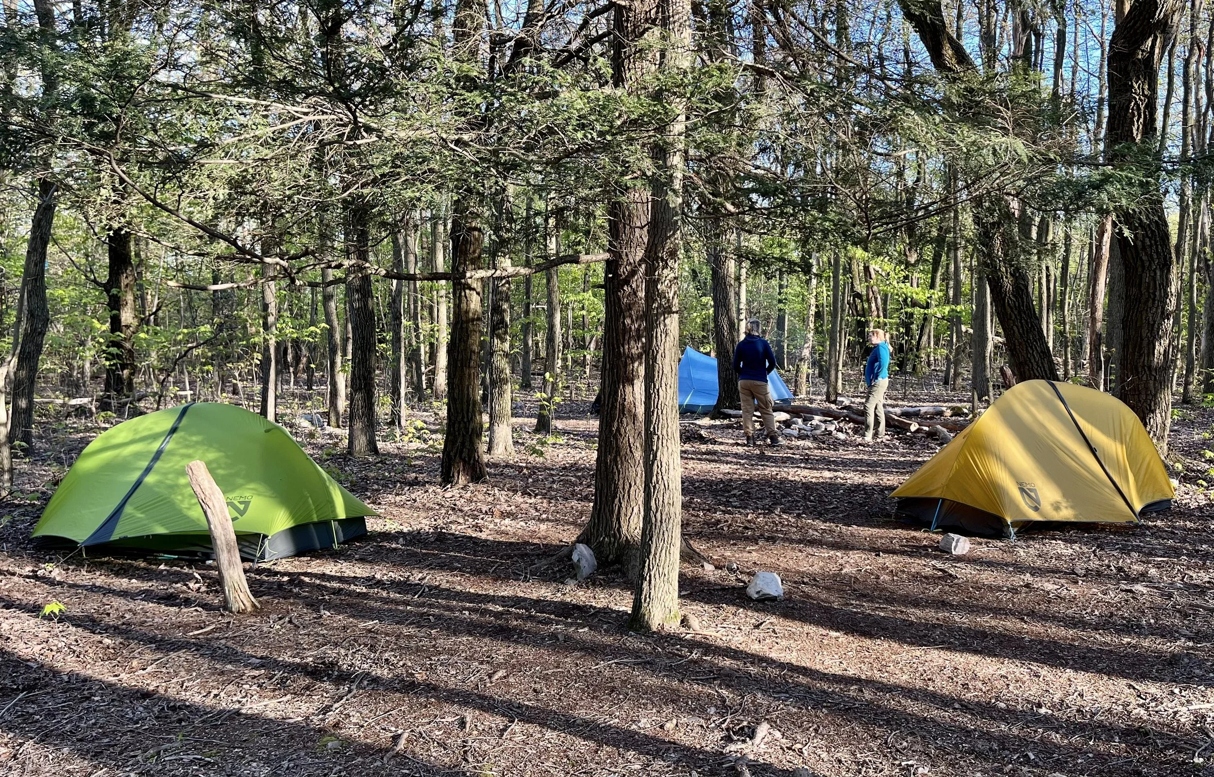
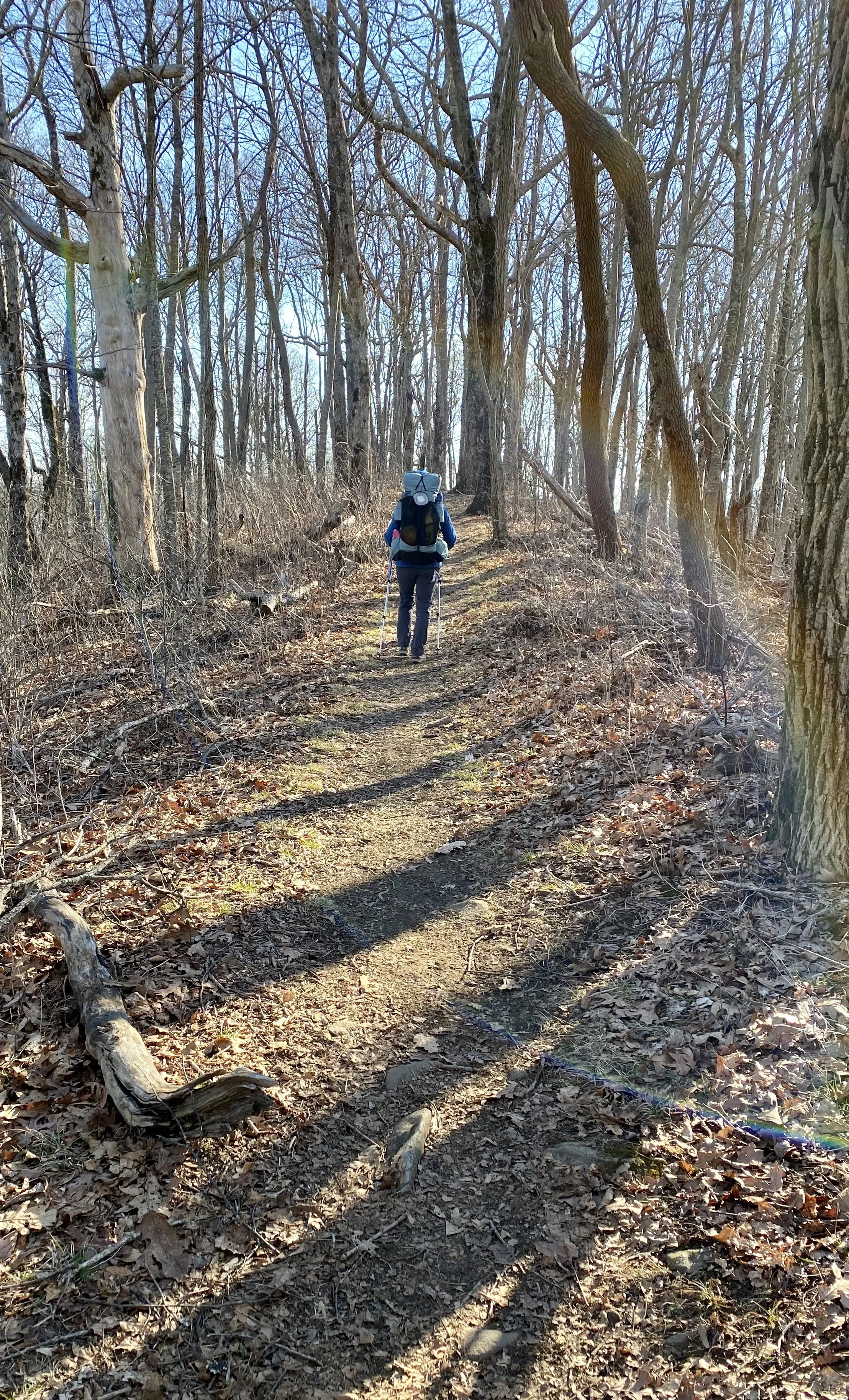
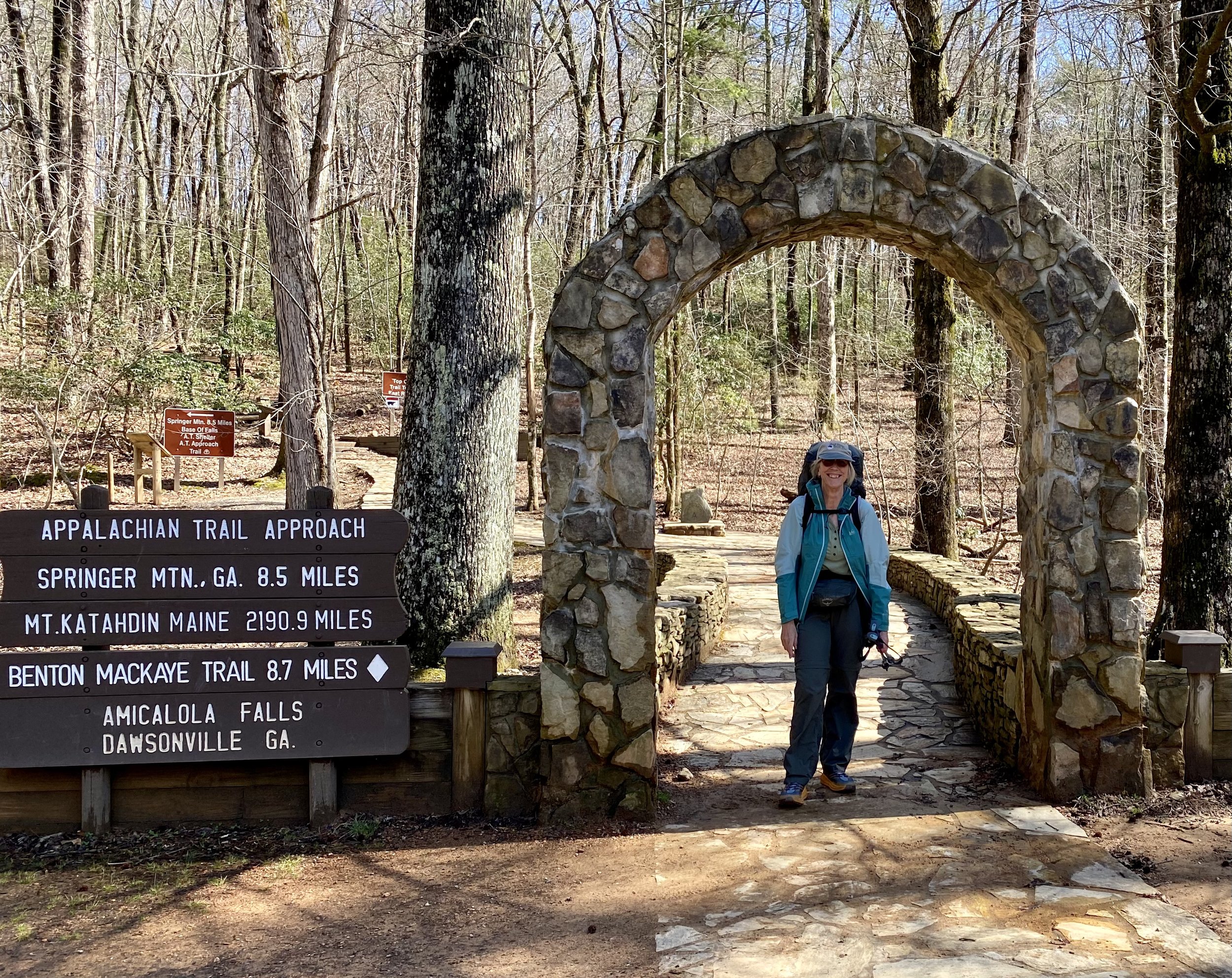
Well, it has been exactly two weeks since I stopped hiking, and I am finally adding my postscript.

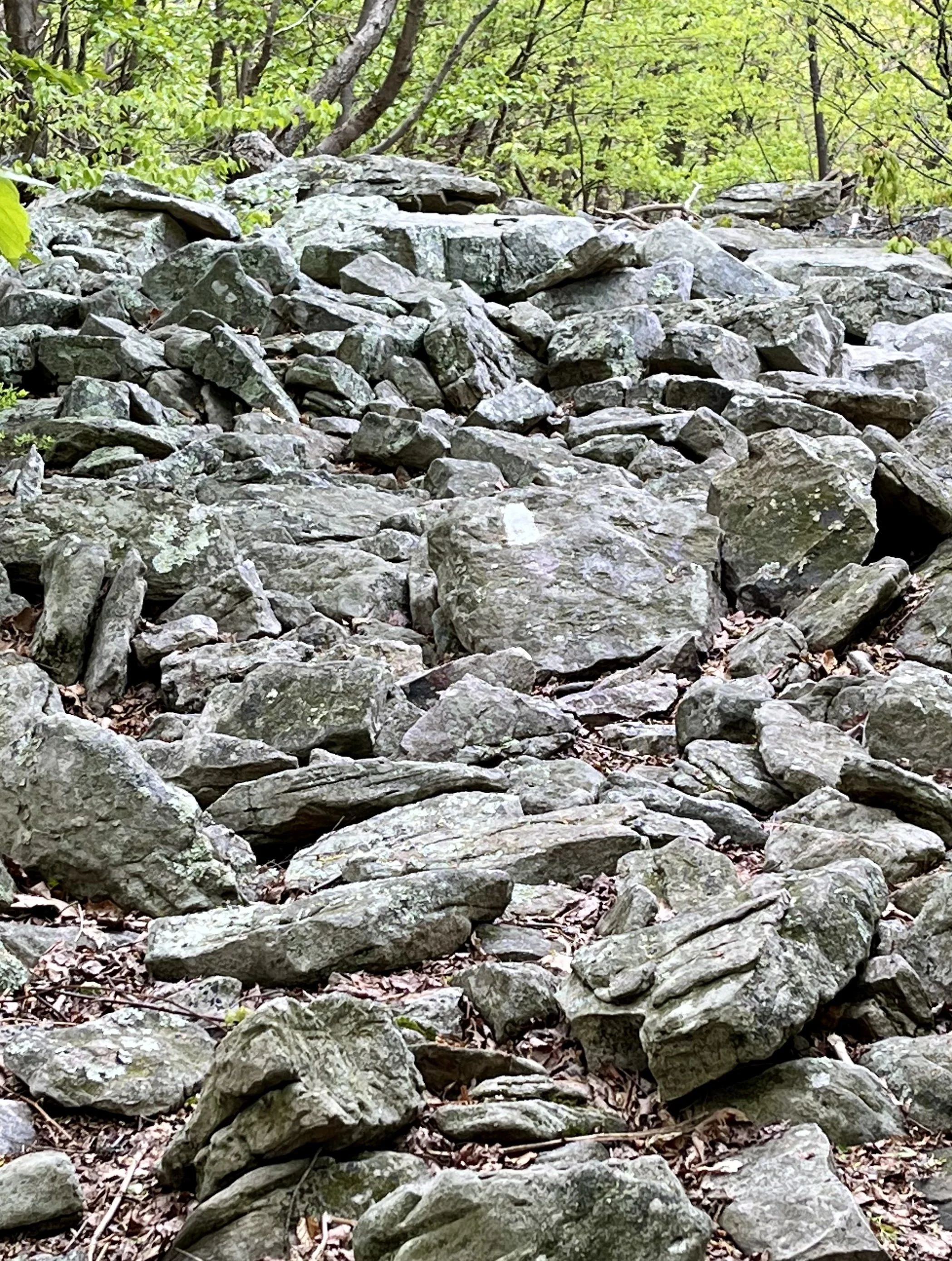
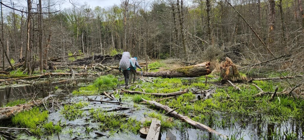
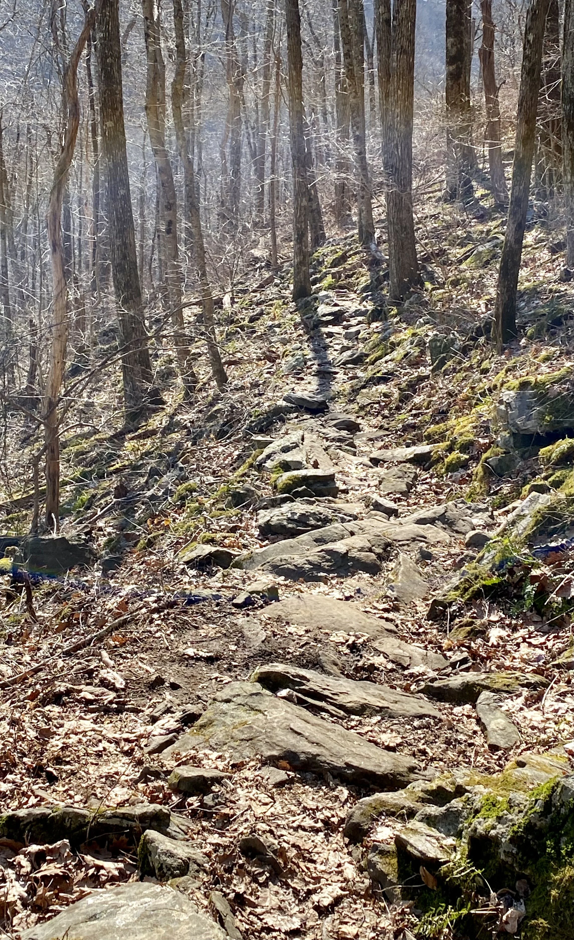
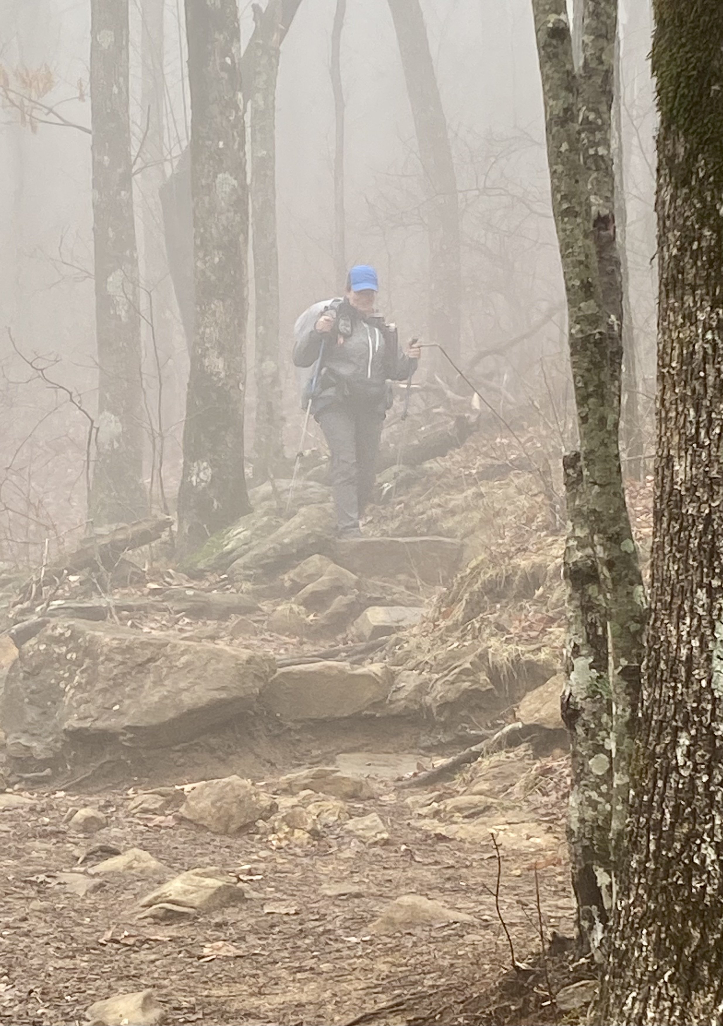
Immediately after my return from hiking, I had one day in Florida to unpack, pay bills, and then pack for a trip to Texas. I had always planned this trip for CC’s birthday and it turned out she made her 1st Communion on her birthday (which was also Mother’s Day).  While in Texas, I finally decided to go to an urgent care to look at my right foot.  It had pained me since hiking; wearing a full ankle support provided no relief.  It turns out if you sprain your foot, an ankle brace doesn’t help much 😊 I tried to remember when I actually started to limp and couldn’t remember.  I told them about the fall I had on May 3rd, however I couldn’t be sure that was when I caused the damage, because I rolled my ankles a lot on the rocks.

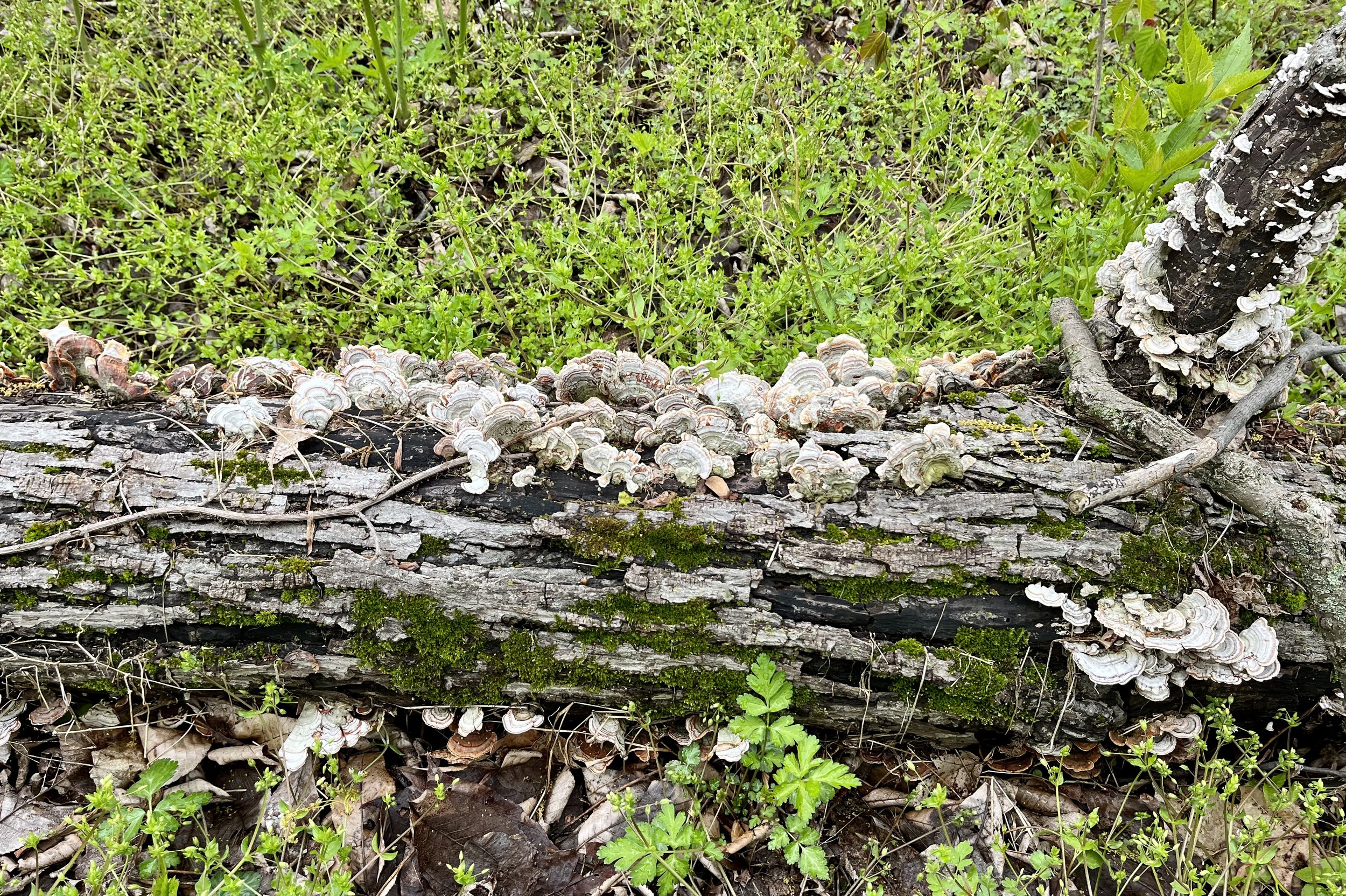
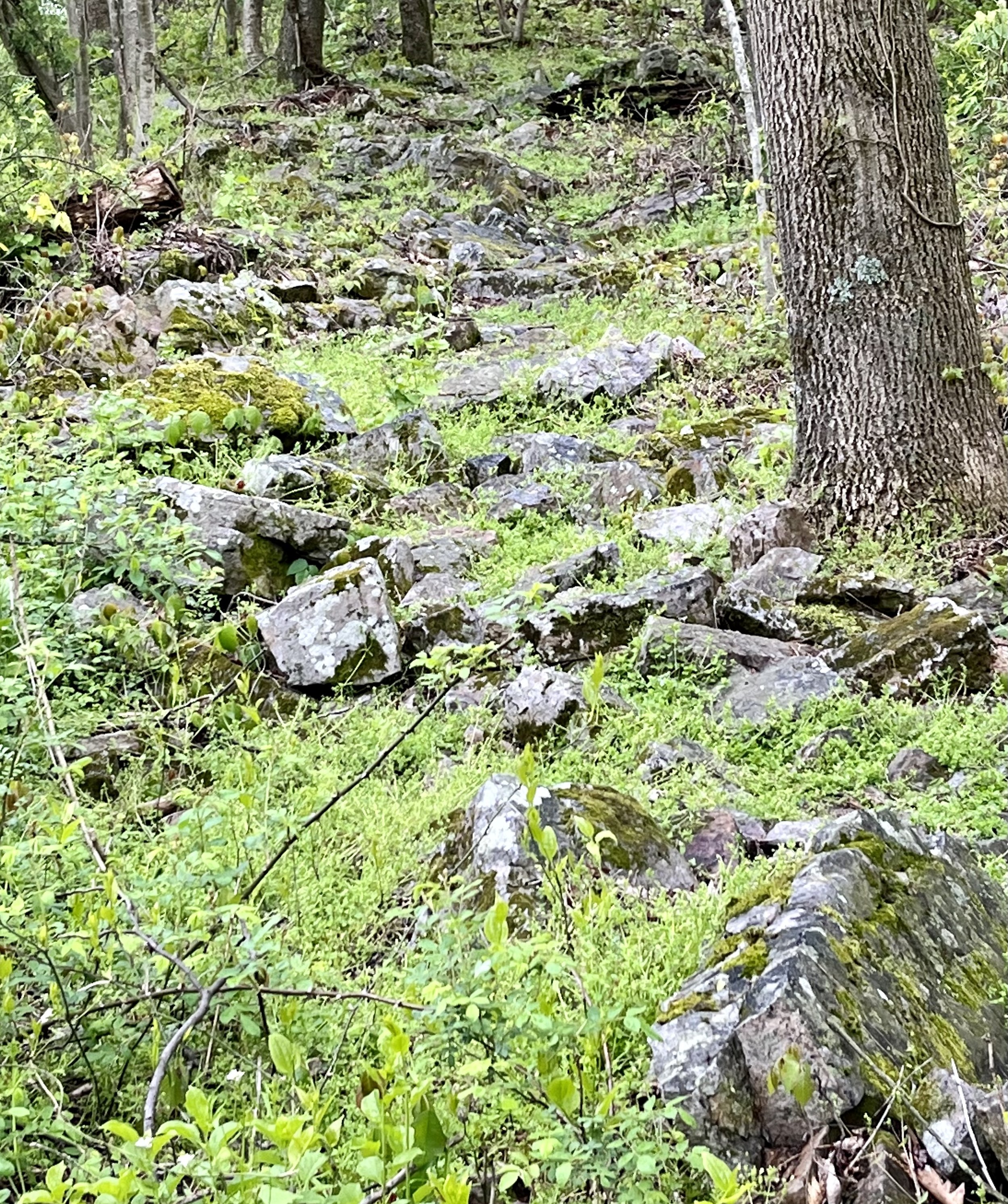
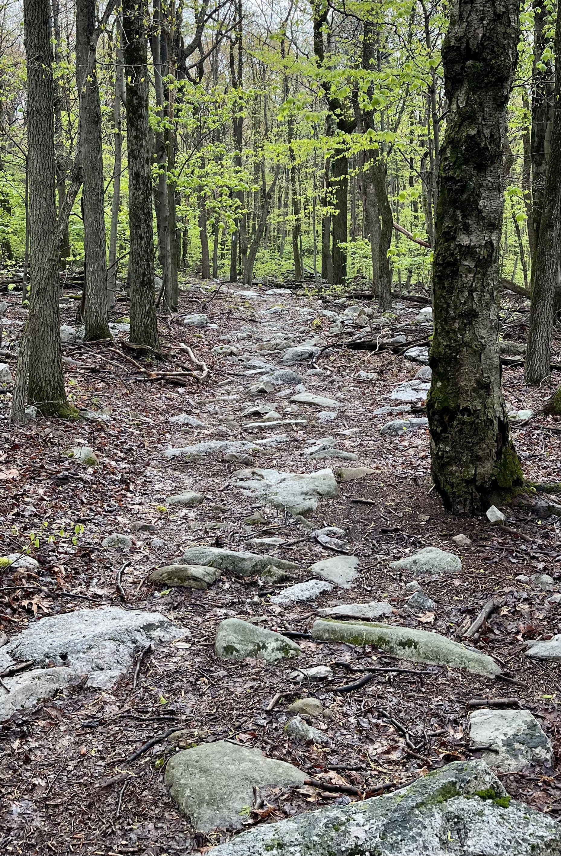
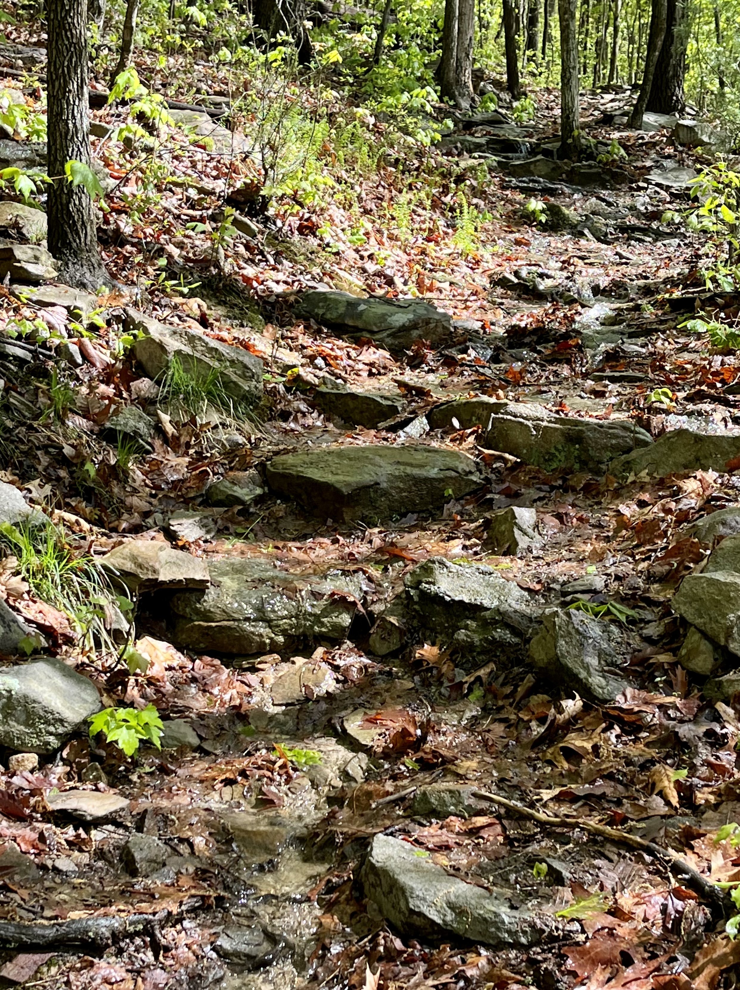
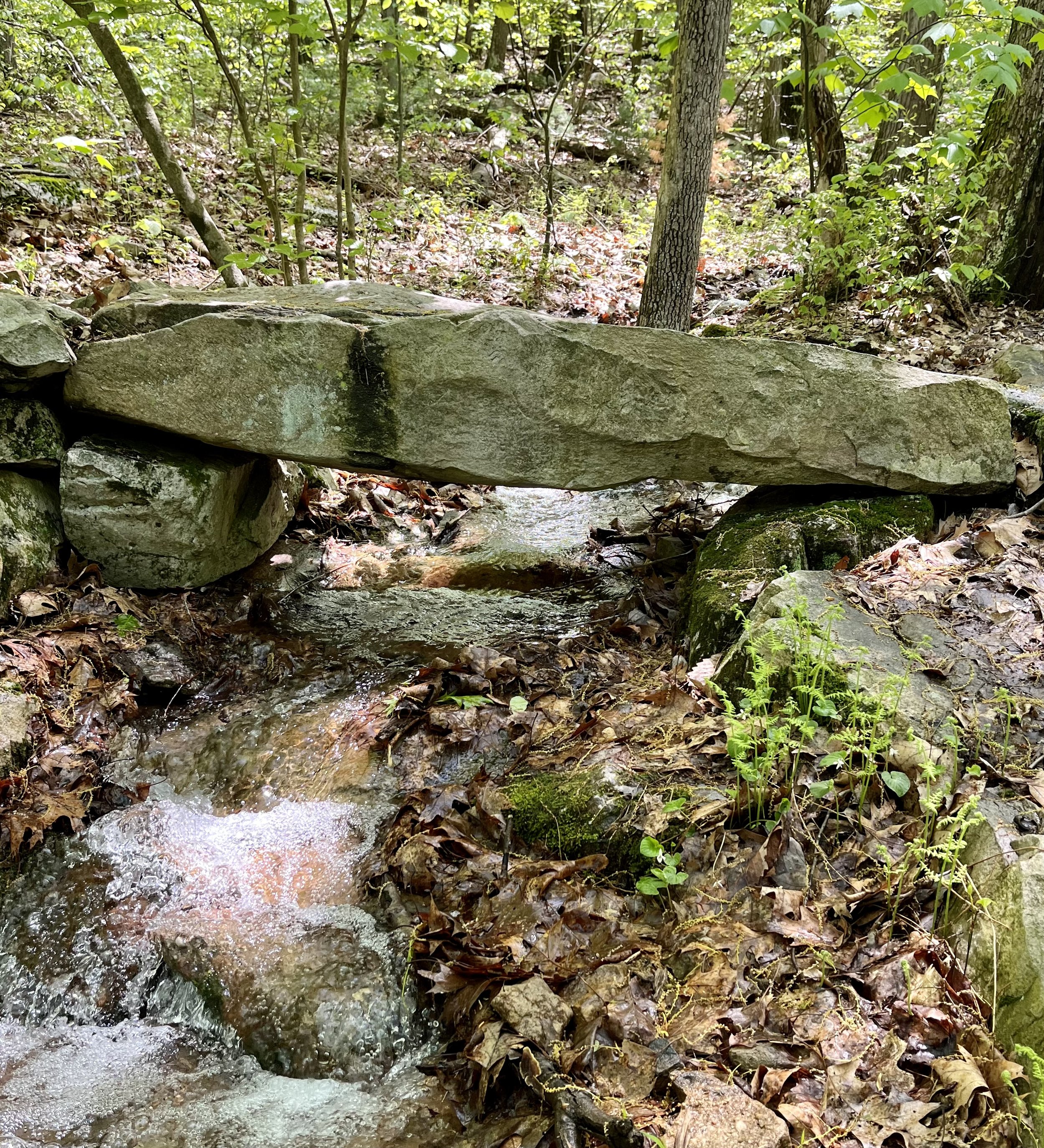
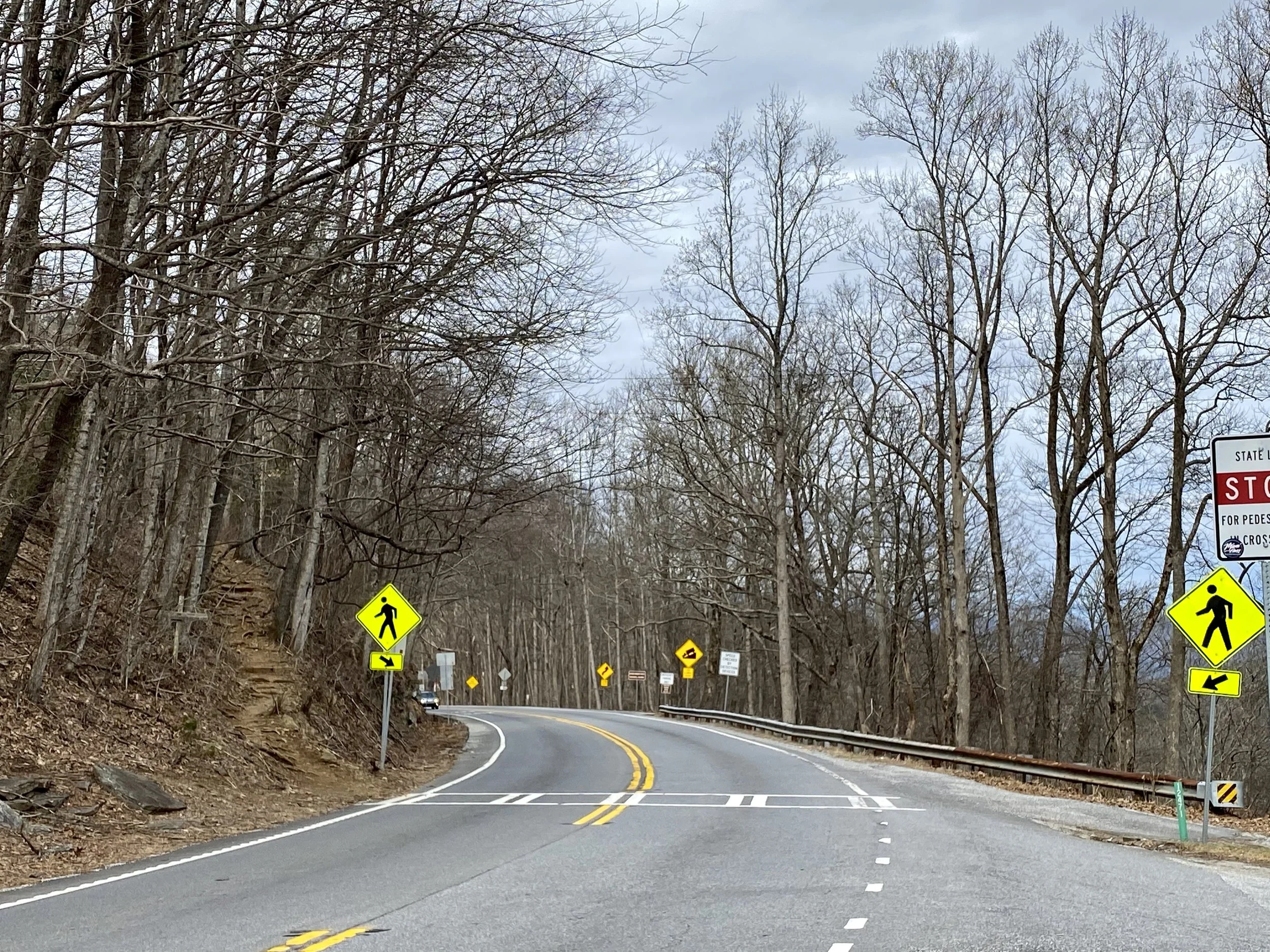
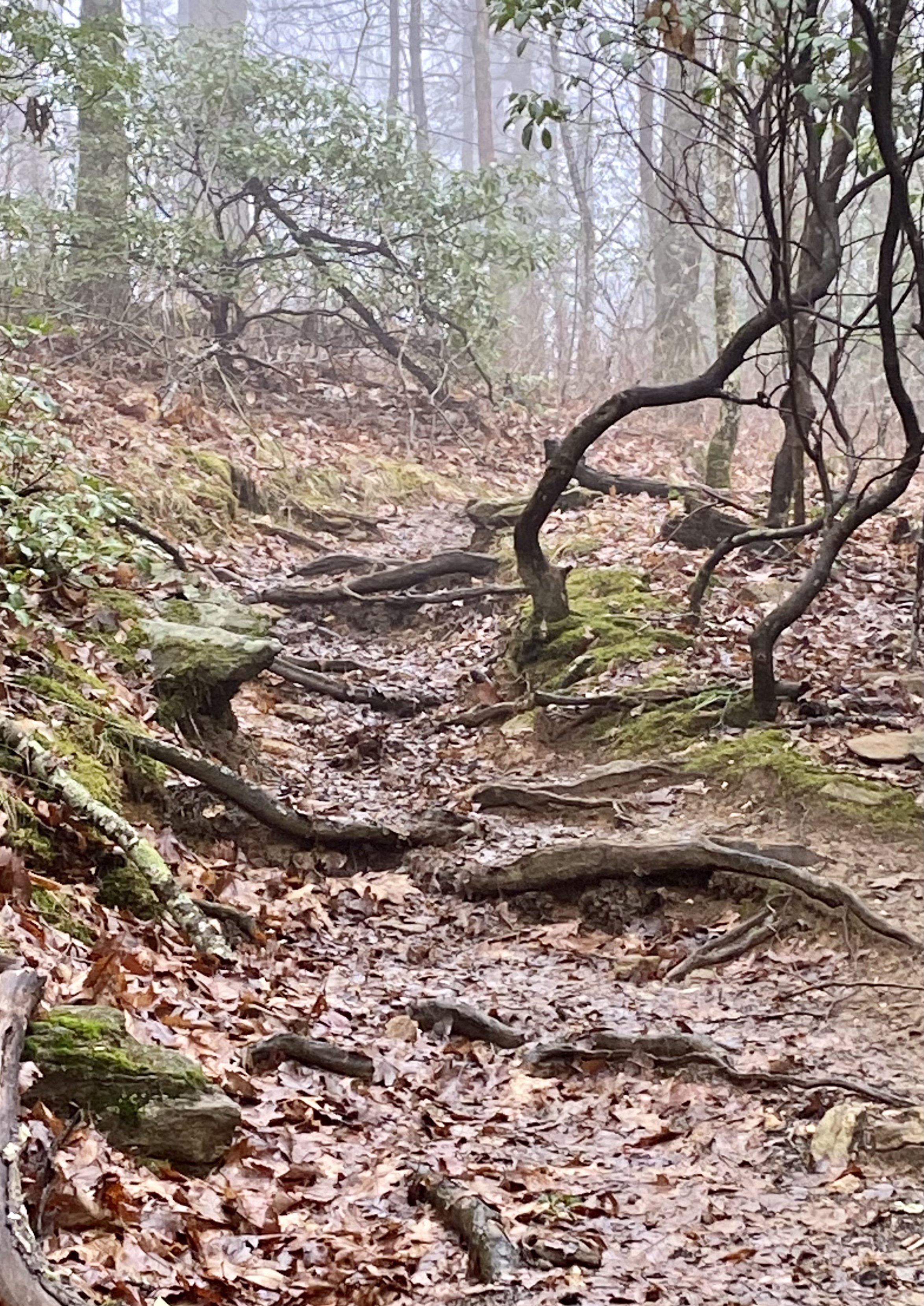
The urgent care suspected a bad sprain, or maybe a stress fracture.  They put me in a walking boot and told me to follow-up with an orthopedic doctor when I got home.  A good biking friend was able to get me into to see my orthopedic doctor the day after I returned from Texas.  Once again, thank goodness for friends.  My doctor confirmed a mid-foot sprain as there was still swelling and bruising two weeks later.  The good news, was he also did not think there was a fracture.  He also told me, without prompting, that I could get back on my bike as soon as I could wear a normal shoe without pain.  He added to keep using the boot until then. I cannot wait.  Between my broken wrist last year with subsequent second surgery, my bike frame breaking in April, and then hiking and bum foot, there hasn’t been much biking in the past ten months.  I can’t wait to get back to riding my bike!  As for hiking, my orthopedic doctor told me that I didn’t have to retire from hiking, “just maybe stick to weekend trips.”  And I thought “and trails not made almost completely of stone!”

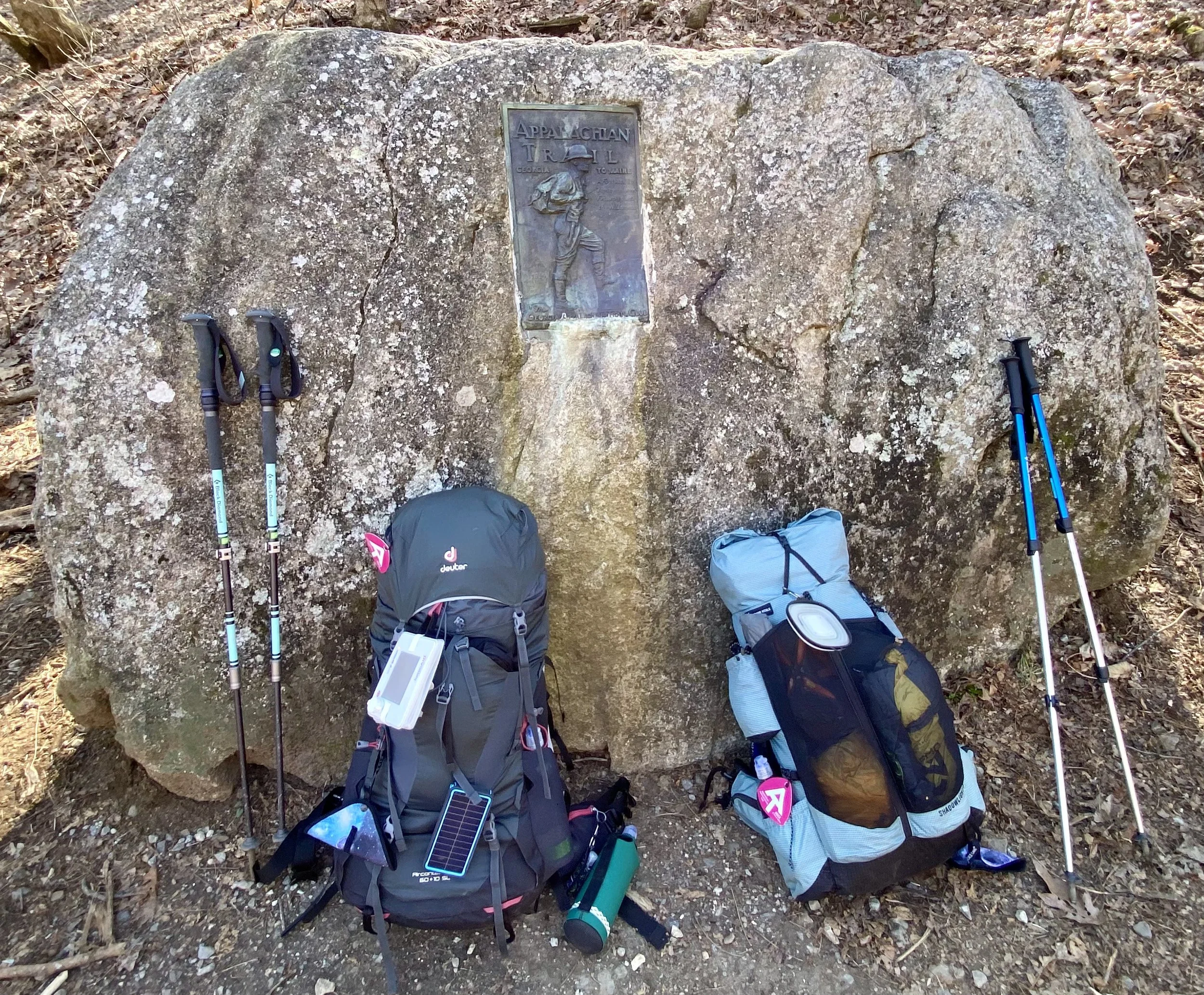
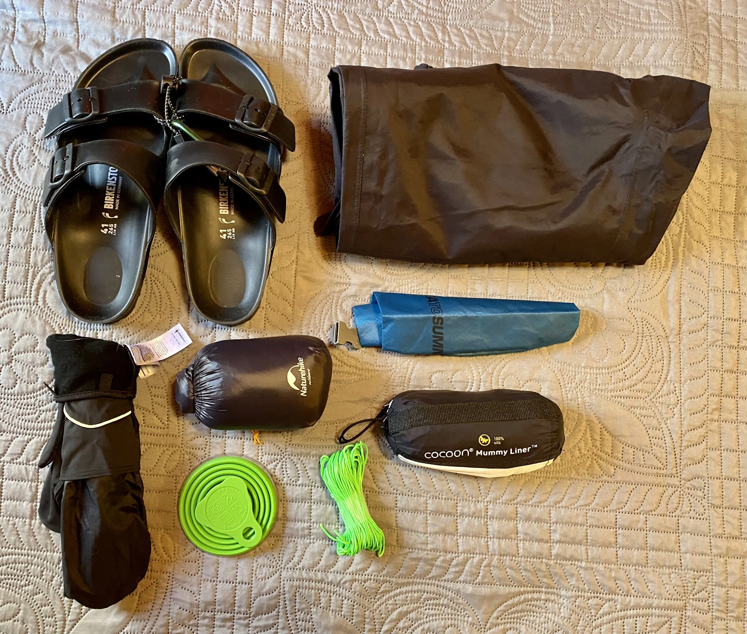
Boots that I used hiking the AT in Pennsylvania.

My “new” right foot boot that I got to use for a couple of weeks after hiking the AT on Pennsylvania’s stones.

Day 8 Leaving Port Clinton

After a hearty breakfast at the Blue Mountain Family Restaurant, it was time to check out of the Motel 6 (and probably on the list for worst ever), and then say “see you later” to Julia and Adrian. Donna hiked a bit up the trail with them, and I went to scout out the local post office. When Donna returned we went to the Port Clinton Peanut Shop. The store had every candy that I recalled from my childhood, plus some of the best caramel corn. After satisfying our sweet tooth, we headed to the hiker pavilion in town to wait for our last shuttle driver. We have one more night until our flights tomorrow, so we opted to head to the airport and stay at a “real” hotel. I wish my feet and one ankle were in better shape so I could have hiked another day, but I knew it was time to stop. As we waited, I witnessed my first ever full immersion baptism in a river. It was a moving experience. Once at the hotel, Donna and I had lunch and a celebratory drink at the Red Robin next door. Donna has since headed out to shop, and I am icing my one ankle. It will be fine in a couple of days with rest and no rocks! I look forward to my next adventure…back on my bicycle!

Our last group photo of this trip.

If you look closely at Adrian’s pack, you can see a can of beer in each of his side pockets. He purchased them yesterday. I could never afford to take along the extra weight.

The trail out of Port Clinton before it quickly began the steep uphill.

Soon enough, they will be hiking along the top ridge.

Port Clinton Post Office.

Waiting for the shuttle driver.

I did soak my one foot in the cold water, and Donna caught me drying off the foot.

One of the local church members being baptized in the river.

An Old Fashioned to cap off the trip.

Wildflowers

Day 7 Mile 1216 to Port Clinton (Mile 1220)

It was a cool start to the day as the low as 42. Today is my last day of hiking. All of the walking on rocks has taken a toll on my feet and they just can’t do any more miles on rocks. Originally I planned to walk at least to Port Clinton and add miles if I could, as my flight leaves on Monday. I made it to Port Clinton - just no extra miles. I hiked 65 miles this past week and a day earlier then planned.. Considering it is part of the fourth most challenging section of the Appalachian Trail, I am taking it as a big accomplishment. When we got to Port Clinton we were looking for where Cabela's has a shuttle pickup so Julia could resupply, when a local saw me walk by and stopped us. He offered us free coffee, water, restrooms and charging outlets. It turns out it was Frank who owns the local barbershop featured in AWOL’s AT Guidebook. He said I looked pretty beat down, and that was probably putting it mildly. He referred us to an 82 year old shuttle driver named Steve who moved us to a different town so we could get a hotel room, drove us to Cabela’s, dropped us off at the 1787 Brewery in Hamburg and then picked us back up. He was a former hiker and big supporter of the hiking community. And a blessing. While in Hamburg we also walked to a second brewery, CopperZ (because I just had to get in a bit more walking). I got a head start leaving the second brewery and stopped at a Rita’s for a chocolate soft serve yogurt.

This was the moon at about 1:30 am.

This artwork was near Auburn Lookout along the trail.

Auburn Lookout.

Near the end of the almost two mile descent into Port Clinton. Impossible to get photos to show how steep it really is.

For a different perspective, this snippet from the Far Out App shows the descent into Port Clinton.

At the end of my AT hike (and the end of the descent into Port Clinton). The trail is directly behind me.

The barbershop keeps a running log of the hikers who come through. My note is on this page.

Our group with Frank, the barbershop owner.

My flight at CopperZ. At 1787 I had a pulled pork sandwich and a single local brew.

Adrian sent us this description of where we had just hiked. The description is no exaggeration. The one benefit to the rainy cooler weather we had is that we didn’t see rattlesnakes sunning on the rocks. Hikers have seen them under different weather conditions.

Day 6 Mile 1206 to Mile 1216

As we headed out of camp this morning, we realized we had stopped about 100 yards short of the “official” tent site. That explains why we couldn’t find the blue blazed trail to the water source. Where we stayed had tent sites and a fire pit—it must have been the “suburbs” of Swatara Camp. We hiked just under ten miles because we were trying to make the timing work going into Port Clinton the next day. I, for one, was glad today was a shorter day. I’m just sort of overall tired. It was a day like the others, some climbs, some rocks, and some not so bad terrain. One big difference today — no rain!! At one creek, we took off our shoes and soothed our tired feet in the cold water. Little did we know it was our last water source of the day and we all are on limited water till tomorrow. Because we stopped at camp earlier than the past few days we were able to relax a little.

Starting out in the morning. Something I never mentioned before is that, in addition to my backpack, I wear a waist pack (normally hanging in front of me). In that waist pack I carry the days’ lunch and my Verizon hotspot (in the event my phone can’t get a signal with T-Mobile). It keeps just a little weight off my back.

What I thought were all rhododendrons I discovered are actually Mountain Laurel.

Just an interesting tree along the way.

Several miles of the trail were through a prescribed burn area. Not sure when it was done, but at times you could still smell the burn.

Taking a break.

Cooling our feet off in a stream.

The night’s campfire.

The night’s camp site.

Day 5 Mile 1194 to Mile 1206 Black Swatara Creek Camp

After having a warm bed and hot shower yesterday, today I was supposed to get a two mile head start on the other hikers because I am so slow. A shuttle driver moved us from the hotel to where we stopped yesterday, except he moved me two miles further up the trail. There aren’t many times this is even possible. Well, I immediately made a wrong turn and ended up parallel to the trail. Luckily we had cell service and I texted Julia, who called me and talked me back on the trail. When we met up she told me “you know better than to keep going without seeing the white blaze.” She is right. I ended up backtracking a 1/2 mile which added a mile to my hike. So instead of 10 miles to their 12, I ended up with 11. And I am beat. It was a long hard day with lots of rocks and boulders.

A few pictures of the trail when I finally got on the correct path.

White blazes for the trail are even on the boulders.

Julia taking a picture of her feet near her 1200 milestone!

Our lunch stop today.

The sign on the left indicates the “old” AT trail is closed and new route is in its place.

Tonight’s camp.

Day 4 Mile 1182.6 to 1194 (Pine Grove

Another chilly start to the day (about 39), but the first mile was smooth sailing and that made the cool temperatures not so bad. Very early on we came to a pretty deep and fast stream, however someone had created a small detour with a wooden plank for crossing!! I appreciated that detour. There were times on the trail today where the rocks were more like boulders and it was difficult to figure how to get through. At one point one of my hiking poles went straight into a hole and I lost balance and fell. Nothing broken and Donna was nearby, heard me fall, and came back to help me up. Thank goodness for friends on the trail! We did a total of 12 miles and when we got to that point, there was another hiker giving out his last couple of beers, so Donna and I each had one. Then we shuttled into Pine Grove, checked in to a Comfort Inn and then headed to a pub for dinner. While I was hiking I thought about how much I would eat, but then struggled to get it all in. At the hotel we are recharging, washing all of our clothes (the little we have) and drying out our tents for the first time in four days. And yes it did rain and hail on us again today. It will be so nice to sleep in a dry environment tonight!

This photo was right after we crossed the stream using a wooden plank.

Julia crossing an area that looked to be a pond in better times.

A rhododendron tunnel.

May Apples were everywhere and most in bloom. I didn’t get a picture of the flower. Dogwoods were also in bloom.

Had to get a picture of some mushrooms to show my nephew Brian.

Our lunch stop today.

Wild geraniums.

The “good” part of the trail above. And then there are the rocks…

The beer from one of the hikers, his friend is a through hiker photo bombing in the background.

Loaded french fries for an appetizer.

An 8oz burger for dinner.

Day 3 From Mile 1171 to Mile 1182.6 Campsite

It was pretty cold last night as it got down to 38 degrees. I never thought it would be colder hiking in May than it was last year hiking in February/start of March with Julia. I changed to just a 30 degree sleeping bag to reduce the weight I carry and now I regret that decision. Live and learn. I hiked 12.7 miles which if you look at the title of today, you think I have bad math. However, we did extra mileage going to a shelter for lunch. It was worth it to take off our packs, sit, refuel with food and use a pipe fed spring for more water. The weather today had a little rain and a little hail, but overall not bad. The high never got above 50. There were LOTS of rocks today. I am grateful that I am wearing both ankle and knee supports because the rocks really are tough to traverse. We also crossed a beaver dam bog today. I did put one foot down into the water as I misjudged one step. I had help getting onto one log as I just couldn’t step up with my pack on. Thank goodness for friends!

First water resupply of the day.

A lot of the trail today followed water “paths” created from all the recent rain.

Rhododendrons were aplenty along the trail. Too bad they were not in bloom yet.

The piped spring at the shelter. For my lunch I made coffee!!! My first coffee on the trail. We also refilled our water supplies.

The start of the beaver dam. That board was the only man made help getting across the bog.

You could see the remnants of a forest fire along several miles of the trail today.

Tonight’s camp above, and me crossing the beaver dam bog is the picture below.

Day 2 Victoria Crossing to Mile 1171 (Stealth Site)

This morning we had a bag of mixed weather. It rained and hailed, then the sun came out briefly, and then rained and hailed again. We stopped at one overlook for a beautiful view. We filled up water bottles at one of the many springs, but my photo didn’t do it justice. Donna and I spotted some native vegetation and they are in the pictures: a pink lady slipper and a native rhododendron. We had a true river crossing today. I borrowed Donna’s sandals and Adrian helped me across. I can’t afford a slip and fall in the river. We hiked about 9 miles and stopped kind of early because we had a great spot. A fire pit, stone “chairs,” pine needles for ground cover. We all dried out some of our clothes that were still soaked from yesterday. I’m glad we stopped because I was tired. At the end of the photos is a picture of my tent site tonight. I also spotted a pretty butterfly.

Day 0/1 PA225 to Victoria Trail Crossing

Today started early with the alarm going off at 3:30 am for a 6:20 am flight. I am to going to try and hike more of the Appalachian Trail with Julia. I Flew to Harrisburg, PA via Atlanta and arrived about 11:30am. Julia arrived about 1/2 later and we met up with Donna & Adrian an hour after that. We were dropped off on the AT exactly where Julia stopped last year - a parking lot along the trail at mile 1158. We planned to hike three miles and went a little further for a total of 4.5 miles.

My photos today are limited because it rained all day. The area was forecasted to get up to two inches of rain. The last I checked the weather it was at 1.5”. It was the first time I’ve put up the tent in the rain while on the AT. I’ve taken it down in the rain and neither is a pleasant experience. Even with rain gear on, my clothes are wet. My boots and socks are drenched. With any luck we will dry out a little tomorrow. I know it will be tough putting on wet boots. I did have a pair of spare dry socks in my backpack. Yay! The first photo is where we started - it was the last bridge Julia crossed last year. The next two photos are of the trail: rocks and lots of water and mud.

Much of the trail was now covered in water.

Post Script 2022 - March 5, 2022

I was 45 minutes away from home (feeling glum because I had left the hike), when a neighbor called. She asked “does someone have a key to your house? There is a fire and we need to turn on your sprinklers.” The person with a key was not nearby. When I reached the intersection near my home, all I could see were flames and smoke. I thought, “they couldn’t save my house.” I rolled down my car window and asked the fire fighters near the road if they saved the house in the back. The said “yes” and the feeling of relief is something I can’t even put into words. The Fire Department told me that my neighbors' quick actions saved my home. They were using all of my hoses. So did the Fire Department. The fire came within about 12 feet on one side of the house. I guess there was a reason for me to leave the hike. As I continued to help hose down, one of the fire fighters said “you're hired.”

Fire fighters using two of my hoses to water down hot spots behind my home.

A neighbor using my hose to water the lawn on the side of my home.

The Forest Service creating a fire lane on my vacant lot next door to my home.

Small fires burning behind my home, behind the fire line, as the Fire Department stands ready if needed.

Fire fighter in my backyard.

When my elderly neighbor passed away a few years ago I “inherited her Virgin Mary and Jesus,” because my granddaughter loved to visit her and her statues. There is still smoke coming from the leaves/under brush. I think she was looking out for me this day.

You can see how close to my home the lawn burned. I had new mulch put down while I was on the hike. It caught fire in several areas. Thanks to my neighbor, the fire didn’t reach the mulch next to my home.

I was too anxious to ask his name, or snap the photo, so the firefighter took this selfie.

As daylight faded, and the fire department left, I could see the small blazes from my yard.

In the dark, it looked even more ominous.

Day 8 - Blue Mountain to Unicoi Gap

Well, I am very sorry to say that my journey along the AT has come to an end. I was no longer “hiking” but now I was “limping” from site to site. I promised my daughter and son that if I got worse, that I would stop. I am keeping that promise. I feel horrible leaving Julia already, however, my alternate pickup point was not an option because the forest service road is not open. If I continued, I would slow her down immensely until I came to another pickup point. Tomorrow, my friend Ray will retrieve me from Hiawassee, GA and take me back to my car. The only thing that really eased my sadness was that we ran into my trail angel, Shelli. I mentioned her in days two and seven. She and Julia plan to meet the next three nights at camp. They have different hiking styles, but knowing someone at camp is a comfortable feeling. I’m glad they will be there for each other. When I stopped at Unicoi Gap, there was a trail angel named George with a huge set up of FREE items. He had everything you would need for resupply. He also had a trash can which is a huge thing!! Next trash can along the trail is not for 53 more miles. When you “leave no trace,” you must take out all of your trash. I had a coffee (thanks to George) and pleasant conversation while I waited for my shuttle driver (Michelle again). I hope you check back in with me in my next bicycle adventure. As John Shafer would say, so much easier than hiking the AT!!

Sunrise.

The first mile this morning wasn’t bad. That only meant the next would be torture..,

It’s hard to “see” the large “step down” in a photo. However, I’m not exactly short, and as I tried to step down without causing a new injury, I did manage to fall. I did get myself back on my own. I’ve gotten better at it!

The second mile of the day looked like this…rock. The trail was narrow. Like most of the hike, I avoided looking down due to my fear of heights. Kept my eyes on the trail almost the entire time.

Where the AT crosses Georgia State Road 75. One of the few places, thus far, that crossed a road accessible year round.

Trail angel George. He had everything I hiker could need, and he just gave it to you. He had first aid supplies, instant coffee for the trail, bars, batteries, mini stove fuel, toilet paper, zip lock bags, cereal, fresh fruit. He also had brewed coffee and a pot of homemade chicken noodle soup. He really did have it all. Someone asked what a trail angel is. It’s pretty much anyone on or off the trail that does a good deed. Most times they are people giving you well needed food/resupply.

Julia headed back onto the trail, up a new mountain…without me😞

Our new friend we first met in the trail on day two, Shelli, heading up that same mountain. In the end, I hiked about 40 miles with most of those on the trail with about four making side trips.

Day 7 - Low Gap to Blue Mountain Shelter

We started hiking around 8:30 this morning. After yesterday’s grueling day, starting a little later was great. The first five miles were relatively mild with long stretches of leaf covered trail. However, that all changed with the hike up Blue Mountain. The terrain became very rocky. The rocky surface is painful with my plantar fasciitis and bone spur. I am having a hard time capturing in photos just how rocky it is. It was such a relief to reach camp at about 2:30. I ate half of my lunch then and dinner just three hours later. One of the biggest differences hiking is to biking (for me), is that there are no SAG stops. Do I ever need them. Today at camp, we met back up with my trail angel, Shelli, from Day 2. I forgot to mention before that she is from Allen Park, MI. A super nice person to meet on the trail.

Another beautiful sunrise.

First water stop of the day.

Some of the smooth trail.

Some of the not so smooth terrain.

It’s super windy tonight up on the mountain. Low is supposed to be 44 without a windchill.

Day 6 -Neel Gap to Low Gap Shelter

We started the morning at just about 7am. A local hiker named Bill told us to enjoy the views at Cowrock Mountain - and we did! My camera lens just didn’t do the views justice. We were making great progress until about mile six and then we encountered Wildcat Mountain. Actually the downhill proceeding it into Testanee Gap was super challenging - lots of rock to navigate. Julia and another hiker both said Wildcat Mountain was harder than Blood Mountain. I’ll have to take their word for it. We made it into camp around 4:30 pm totally exhausted. It was a little over 11 miles in about 9 and a quarter hours. We put up our tents, ate dinner and settled in for the night.

Day 5 - Neel Gap

Today is an unplanned zero day. I know what you’re thinking, it’s because of my knee. The good news is that it is not. The bad news is, that Suzie, Julia’s cousin, has a son being deployed and she headed home to spend a few days with him. We waited for her husband to pick her up. Today was supposed to be an 11 mile day. There was no way we would make that in a shortened day. It will be a challenge even on an early start day.

We made the most of the extra time. For me, I went through my pack and from the outfitter store, I shipped supplies home. Total weight shipped home was 2.4 pounds. I also threw out about 2 ounces. I did add back in 2.7 ounces. I swapped out my Showers Pass rain pants (that I used on C2C at 13.6 ounces) for something called a Rain Wrap. It looks like an over-sized grocery bag made into a “skirt.” It came highly recommended at the outfitters. The item that I waffled on shipping back were my “camp shoes.” Mine are the equivalent of fancy flip flops (plastic Birkenstock’s that weigh 8.2 ounces). I need arch support, so I can’t just use cheap flip flops. In the end, they made it into the box.

Next up, while at the outfitters, I had someone there check my backpack fit. I really wanted to be sure I had it adjusted properly. The person helping me said I was “close.” I felt better about that, and even better when he made a minor adjustment. Mainly he adjusted a strap that I have a hard time pulling.

Tomorrow Julia and I plan to be out the door early (we are still at the cabin) and do our best to make that 11 mile day.

If you don’t see a post for a few days, it’ll be due to lack of cell service.

Vintage mailbox setup inside the small store at the cabins.

The items I shipped home. There were items I added very late in planning: mittens to go over gloves, down booties for feet and cold nights in sleeping bag, and a collapsible cup.

We ate lunch inside the store at the cabins. Chili dogs & chips. You could also make a bbq sandwich (pulled pork).

The only place along the AT where you walk through a building. It is at the Mountain Crossing outfitters in Neel Gap.

Day 4 - Neel Gap

I did two short walks today without my backpack. One to the outfitter (about 1 mile) and one to meet Julia and her cousin as they hiked down Blood Mountain (about 3 miles). The knee with brace handled the four miles well.

Blood Mountain is the tallest challenge so far. Julia and her cousin made it! If the mountain wasn’t challenge enough, it rained most of the day and never got above 45 degrees.

I hiked back to Mountain Crossing Outfitters and picked up frozen pizza for dinner just in case Julia didn’t make it before the store closed. You can see the difference in weather conditions from yesterday until today as the next two pictures are the same crossing the trail makes over US 19.

The building in the background is Mountain Crossing Outfitters. The tree in the foreground, and the second photo, has discarded boots hanging from the branches. The word is that the boots/shoes belong to hikers that quit after going over Blood Mountain. If you think hiking the AT is difficult with about 30 pounds (or more) on your back, just multiply that a few times over. Next to childbirth, this is the most difficult thing I’ve attempted. Those of you who followed my C2C know I hated Texas Hill country because of the difficulty level. This is harder for me. So I can understand why some people reach Neel Gap at 31 miles and bid the trail farewell.

The pictures below are from my short hike up Blood Mountain. I stopped frequently to take pictures since I only went up about 1.5 miles.

The rock formation is called Balance Rock located near Flatrock Gap and it wasn’t much further down the trail that I ran into Julia. With the twists and turns in the trail, coupled with the fog, she was pretty nearby before I actually saw her.

Day 3 - Blood Mountain Cabins

I was able to change the cabin reservation and get into it tonight. Then with luck, our shuttle driver from the first day was able to move me to those cabins. What a difference in view from the Quality Inn I stayed in at last night. The view from the cabin deck is the third picture down. I am in Bear Cabin. The interior decorations follow the theme. There is an upstairs loft that is quite cozy. When I arrived here I bought a frozen hamburger that I microwaved. I couldn’t believe how good it tasted! Near the end of the row of cabins is a little shack with a sign on it that says “Water Hole.” There must be a natural spring being diverted inside the shack, because behind it, there is flowing water going back into a small stream that follows the length of the cabins. The last photo is the sign I would have seen if I had hiked from Lance Creek tomorrow. I was able to take the photo because I took a short hike to a local camp outfitter in Neel Gap. I wanted to try and salvage at least a mile today. I will go back tomorrow for some resupplies. I’m just not sure how many days until the next resupply opportunity. It’s three or four days depending on how we do. The forecast for tomorrow is 100% chance of rain. It will not be a good day for Julia. I feel like I am cheating, but I am icing the knee so I can start back full steam on Monday. Lastly: Happy Birthday to the best daughter a mom could have!

Day 2 - Hawk Mountain Campsite to Justus Creek

Well, during the night huge gusts of wind came in, and then the rain. What looked like a great campsite the night before became a pool of mud. It was pouring when we left camp at about 8:45am. About one mile into the hike, I slipped on a large, wet tree root. It was a scene out of “I’ve fallen and I can’t get up!” My arm got caught behind me and my pack, heavier from all the wet gear, held me down. With Julia‘a help, I got up without taking off the pack. About a mile later my knee started to hurt. At about mile 2.5, I almost stopped, but kept going until about 4.4 miles and called for a local ride. I had a cell signal and I had reached a parking lot that crossed the trail. I did make it up and over Sassafras Mountain which was a challenge, but the view was worth it. In my original post, I forgot to say I met my third Trail angel named Shelli. Shelli, KT taped my knee on the top of Sassafras Mountain. She is hiking, she is a nurse, and she knew how to tape it!! I went to an urgent care and was told I likely only sprained my knee, and after a day or two of ice/rest, knee brace and pain meds, I could get back on the trail. So that is how I am able to make a post, because otherwise, I would have no service. I’m in a cheap hotel for the night. I do plan to get back on the trail. I have some logistics to calculate tomorrow as it is hard to reach Julia back on the trail. But as she said while waiting for my ride “hey we worked for the post office for thirty years, we know how to come up with solutions!”

Day 1 - Springer Mtn to Hawk mtn campsite

The rookie that I am with my Garmin Watch, I forgot to “start” after I selected hiking as the activity. We did hike 8.4 miles. We started at the Amicalola Lodge, hiked to the official start point (or ending point if you started in Maine), and then hiked to the Hawk Mountain campsite. At the top of Springer Mountain is a boulder with a plaque and a drawer that holds a “sign-in book.” We started later than most people and then went slower than we thought. That meant we didn’t get to camp till about 6pm, just before dark. Julia skipped her hot meal, but I did not. I had freeze dried chicken pesto pasta (reconstituted). Not bad when you are very hungry. We met a hiker from Pennsylvania (hiker name: Hattrick) at about our second mile and he ended up hiking the rest of the day with us. A super nice guy that will be in Julia’s video when she posts. The trail varied from rocky to muddy. It rained enough to cover our packs, but eventually stopped. We haven’t had cell service, and there’s a reason I have it Friday night (I’ll post why in day two). During the day, we saw Long Creek Falls. They were worth the walk slightly off the trail. At our lunch stop we met a few more hikers. During conversation, I learned both Hattrick and Julia’s cousin are long term cancer survivors. The topic came up because another hiker at the lunch spot was also a two year cancer survivor and was hiking the AT with a colostomy bag. I was in awe of her determination. If you’re interested in Julia’s YouTube link, search: Juliasigghikes once you are in YouTube. I’m sure I’m already forgetting things…

Day 0

Going back to yesterday (Day -1), I drove to my friend’s home in Peachtree City, GA. Ray and his wife were gracious enough to let me stay over until today and then shuttle me to Northsprings Station on the MARTA in Atlanta. After meeting Julia at the Atlanta airport, she and I had planned to take the Red Line to the Northsprings Station. But because all good plans need updates, the Red Line was down for rail replacement, thus Ray moved Julia and me instead. Ray became our first trail angel. Once at the Northsprings Station, we took another shuttle, for about an hour, to the Amicalola State Park Lodge. We checked in at the visitor center, had an AT hiker orientation, registered, got our backpack tags (I’m number 457), and weighed our bags. I am bummed because my pack weighs 33.5 pounds and not my estimated 30. I know it will reduce as I eat and use up some hand warmers (for sleeping bag at night when very cold). Plus, it is actually much warmer here than anticipated and I am carrying two layers of clothes. It is going to cool down in about three days, so I will be wearing some of the weight. Right after we took the traditional picture at the Visitor Center Arch, we encountered our second trail angel named Steve. He is from Indiana and he handed each of us $10 for supplies along the trail. What kindness!! We have also met at least a half dozen other hikers starting tomorrow. With my number of 457, the hikers that have started so far this year are at least 100 more than the same time last year. We met up with Julia’s cousin, Susan, for dinner. She is planning to hike most of the trail with Julia. We start tomorrow!!

Top photo is from the Visitor Center Archway. A couple photos of us at the station moving our bags from Ray’s car to the shuttle driver’s car. Next photo is another at the Visitor Center Archway. Next is my loaded pack with my pink AT tag. Then Julia and I outside the lodge. The last photo is the cider I had at dinner. Tomorrow’s menu: freeze dried food and protein bars.

Pre-Hike Prep

Although this isn’t a cycling caper, I decided to add this adventure to my site. The photo for the index page of this post is from June 2018 when I hiked for five days in the Smoky Mountains with my friend Julia. This photo is from the Appalachian Trail (AT) near the Icewater Spring Shelter which is 100 miles further north than I will be going. The start of the hike is just over two weeks away and it seems like I have been gathering supplies for over two years. My friend, Julia, knew she would do this hike when she retired and that time is now. I asked for hiking poles as a 2020 Christmas present and will be putting them to the challenge. Below is a series of photos of the all the supplies I will be taking. If I were doing the entire hike, I would ship back the cold weather winter clothes once spring was in full swing. I am also taking more food than I should to start because I am taking freeze dried fruit. That is something you can’t just get at a gas station and I wanted at least a little “comfort” food for a few days. The good news is, as I eat the extra food, the backpack will only get lighter! My “base weight” is about 23 pounds. Base weight does not include the clothes you are wearing nor the food/water which are considered consumables. Including food, my backpack is about 30 pounds. I plan to carry my water on my waist bag. Two items that I purchased that are not making the trip include an ultralight camp chair (18.5 oz) and a hands-free umbrella (7.3 oz). I just can’t handle more weight.

We did a pre-hike, in September of 2021, in the Porcupine Mountains of Michigan’s Upper Peninsula. It was just a few days of hiking, however we did set up our tents, carried our backpacks, ate freeze-dried food and worked out “the bugs” in our equipment needs. Cell service will be spotty at best along the AT, however I will try to post as often as I can. I will only be doing 100 miles; my friend aims to complete the whole darn thing!! I am sure with good luck, and a couple of pairs of hiking boots, her determination will carry her all the way.

Backpack full, along with poles. Two solar charges (one doubles as a light) and camp shoes are attached. Not shown, but inside side pockets are hand soap & sanitizer and a headlamp. Weight is about 30 pounds including around six pounds of food.

The main contents: (back row, L to R) sleeping bag, tent, inflatable sleeping pad (with an R factor of 4) and extra foam, sleep clothes. Front row: gloves/mittens, tent footprint, backpack rain cover, rain coat/pants.

Food bag (bear proof?) with reflective tape, cook stove & cup/pot, odor proof bag with food, and a bag of toiletries/some first aid. The water filter and empty water bottle will not be inside food bag.

What’s in the odor proof food bag within the food bag: three freeze dried meals, several different snack/breakfast bars, instant coffee & creamer, almond butter and lots of freeze dried fruit. There are a few extra bars & freeze dried fruit not shown. The only thing left to add are small fajita wraps for the almond butter. An ultra light spork is missing from the photo.

Odds & ends that will go inside the hyperlight grey bag: first aid, female urination device in brown bag, cord for hanging food bag, lighter, camp towel, inflatable pillow, night splint for plantar fasciitis, mini foldable brush, duct tape (for repairs), disposable masks, and a bunch of electronics (including a hotspot to try and get a phone signal). We do hope to get a hotel room once in a while to recharge ourselves and our electronics. I plan to use a solar charging Garmin watch to track mileage so I don’t have to keep asking “how far have we gone?” like I did hiking in Michigan.

Clothes worn: quick dry pants (can convert to shorts), black hoodie, base layer grey wool top, green “bugs away top,” waist pack (to carry hotspot, Chapstick, suntan lotion, safety spray, and that day’s snacks), gaiters to help keep bottom of pants dry, cap, neck buff, hiking boots, and a puffy jacket that can compress into its own pocket plus wool socks (not shown).