Hike Reflections

On the drive home, Alan and I stopped in Chippewa Falls, WI. We needed a rest stop and neither of us had been here before. We visited the Lienenkugal Brewery where we enjoyed a sandwich, homemade chips and a flight of beer.

We discussed all the planning that went into this hike and how so much changed. Initially we were supposed to start hiking at the Northern Terminus and head south. Our goal was about 58 miles of hiking. A few weeks before the hike, the location start changed to mid-way in the trail and hike near three state parks. We left weeks before the hike due to our prior bike trip, which meant we packed for all kinds of weather, but especially cold weather. As it turns out, we had warm pleasant weather. I even had to buy a souvenir t-shirt to replace my colder weather shirt until we reached our car where I had a different replacement shirt.

Which brings me to our plan to car ‘leap frog’ with Julia’s car. Having a car available made it easier to change plans. And we certainly changed plans. After two long days with heavy packs on tough surfaces, we opted to primitive camp at the state parks, however a car was always nearby. We then hiked within the state parks.

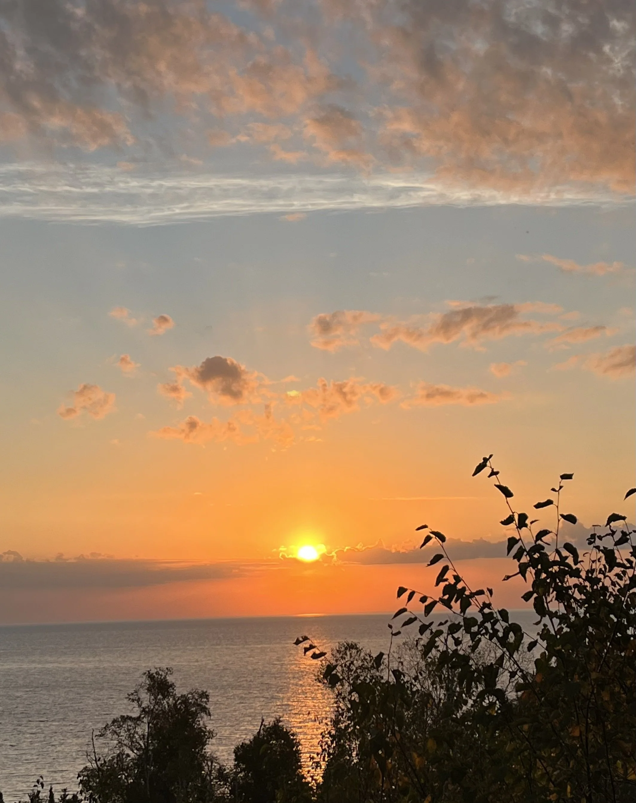
Alan and I both decided the Superior Hiking Trail was intended as a complete through hike objective, rather than a section hike. Maybe we did the wrong section, but it was tough with few rewarding views along the way. Somehow we thought we would see more of Lake Superior from the trail. Also, a lack of water resources the first day made us skittish to keep through hiking versus the state park stays. Spring hikes usually provide better water resources.

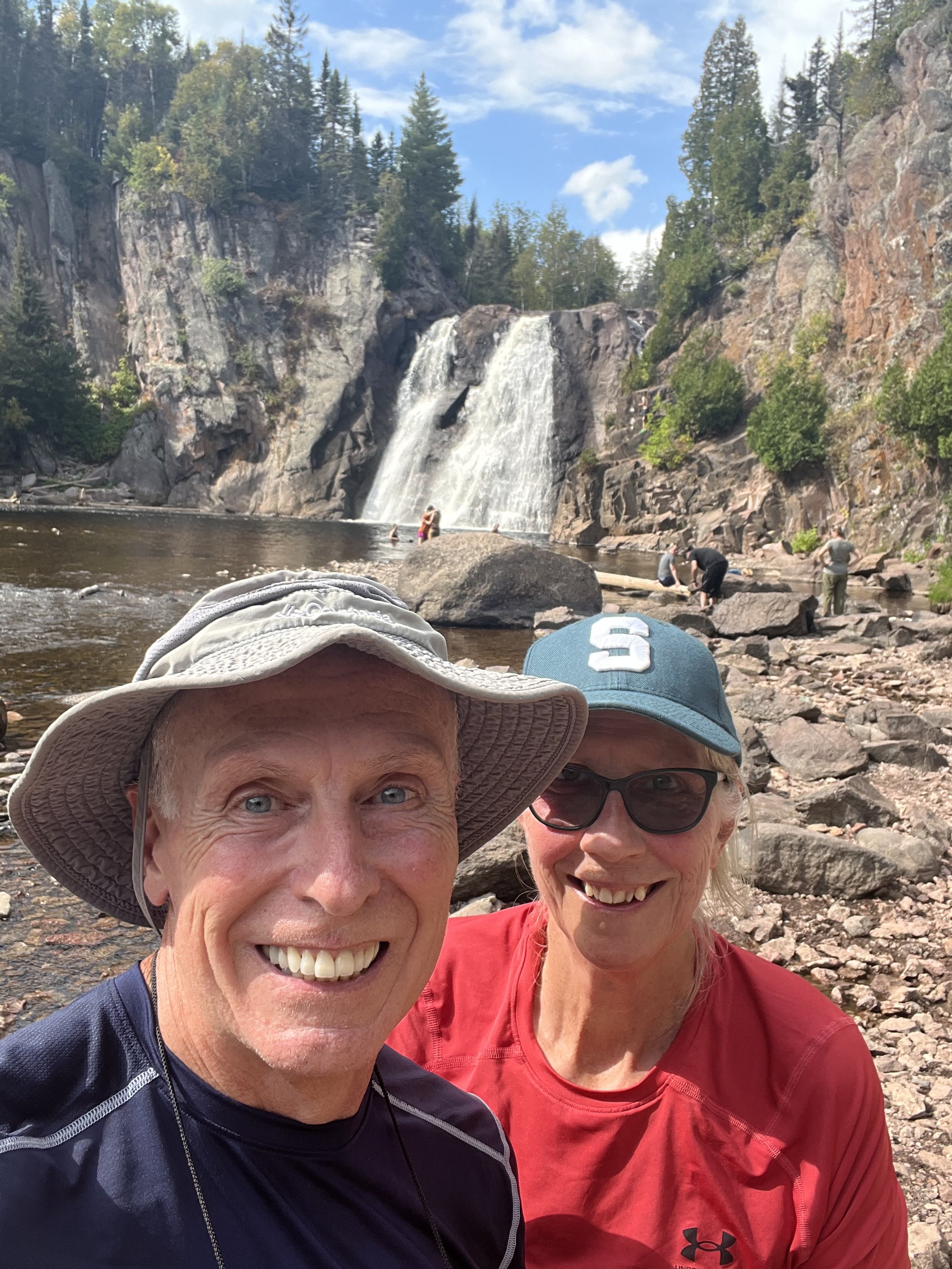
The state parks were outstanding, were the best part of the trip, and made the hiking trip truly enjoyable. Highly recommended the parks we visited.

We made great memories to last a lifetime. A hike for me with zero injuries! We also didn’t hike in any rain!! It did rain the last night, but we were in our tents by then.

Our average hiking over four days was 7.7 miles. The total for five days was 34 miles. The fifth day had less miles because we started the drive home. I think I need to have less miles on my day one. Wearing myself out on day one (10 miles) makes the next day even tougher. Building up to ten miles a day should be my goal. Unfortunately, logistics and trail detours on the first day made that plan unfeasible for this trip. I have a t-shirt with a turtle hiking along a trail. It is a perfect representation of me: I am slow but steady.

Alan had many “firsts” on this backpacking adventure. He came fully prepared for bears: bear spray, a bear horn, and bear bells. He didn’t need to use any! In fact, when we reached the first car, he ditched the bear spray. We talked enough to keep most wildlife a safe distance away.

A big shout out to our friend Julia that kept us laughing along the way. Thank you Julia!!! Alan tapped her for advice about hiking.

We visited the Leinenkugel Brewery on our way home.

Alan’s bear horn, bell and spray. He insists it “worked” because we saw zero bears!

Day 5 Gooseberry Falls State Park

We decided two evenings ago that Friday would be the last day of hiking. We could have hiked from Split Rock St Park to Gooseberry St Park, but opted to break camp and drive to the park instead. It would allow the group to head home sooner than planned.

We arrived at Gooseberry about 8:15 am, well ahead of the visitor center opening and thus ahead of the weekend crowds. We walked to the Lower and Middle Falls. They were beautiful and majestic. The walk to these first two falls was on pavement and also used stairs. From there on we were on typical hiking trails; only Alan carried a backpack with water for the three of us. We hiked to the upper falls, and finally up to the Fifth Falls.

We found Superior Hiking Trail markers near Fifth Falls and agreed that this section of the SHT is what we had anticipated for the entire trail. We understood that the trail could not follow along Lake Superior the entire time, but had hoped for more “rewards” along the way for such a tough trail. We were very glad that we day hiked the Gooseberry Falls area. We walked/hiked 3.25 miles. In the parking lot, Alan and I said our goodbyes to Julia and set out on the road for the long trip home. Who knows where we may stop along the way?!

Lower Falls

View of Lake Superior.

Middle Falls

Upper Falls

The first time we saw a shelter on the trail, and this was within a state park.

Fifth Falls

What you do when you find a bench along the trail!

Saw this sign and thought of my “Coaster” family.😊

This wall, 300 feet long, was built by the Civilian Conservation Corp between 1936-1940. It was built to resemble a castle.

Day 4 Split Rock State Park

Today we decided to hike the trail around Split Rock State Park rather than the Superior Hiking Trail. The views throughout the day were amazing, thus we made a good choice. We started about 7:45 am and the temperature was about 64 degrees. Our first leg was the Little Harbor Trail to the lighthouse. It was two miles out and back. Unfortunately, we arrived before the visitor center opened.

We did a little exploring around the lighthouse, including a long staircase down to the water. It was the site of a tram that serviced the lighthouse from 1916 to 1934. Then we headed towards the Day Trail. Along the way we stopped at Pebble Beach on the shores of Lake Superior. From Pebble Beach we hiked to another set of stairs called “Bob’s Stairs” that took us back down to the beach.

From the second beach we hiked to the Corundum Point Overlook. In 1906 a prospector, named Ed Lewis, thought he found a mineral, called corundrum, which was used in sandpaper. Three mining companies started operations there only to discover that Mr. Lewis was wrong. It was a softer mineral called anothorsite. All operations closed in 1908. The only remnants we saw were some cement pilings.

Next in the hike was to a Split Rock Mystery site where a large stone fireplace stood. Folklore has it that a Dutchman built it as the beginning of a home for his love, only to have her call off the wedding. We ate our lunch at the site.

After lunch we hiked back to the lighthouse so we could go inside. It was an interesting short tour. In total we hiked 7.5 miles. Some of them were easy miles to/from the lighthouse.

As a side note, it is great to be in a state park, however the running water restrooms were a .25 mile hike. I added 1.5 miles that day just going back and forth to the flush toilets!

Thursday’s sunrise over Lake Superior was as beautiful as Wednesday’s moonrise.

Light pack day hiking on the way to the lighthouse.

Stairs along the old tramway near the lighthouse.

Great repurposing of an old mailbox.

Down “Bob’s Stairs” to the beach.

Lake Superior “beach.”

The hike to Corundum Point.

Lunch stop at the mystery fireplace.

Stairway in the lighthouse.

Inside the workings of the lighthouse.

The foghorns on the lighthouse property.

Split Rock Lighthouse up close.

Day 2 & 3 Tettegouche St Park to Round Mountain Campsite and Return

Tuesday we finished breaking camp about 7:30am and then headed to a trailhead to start hiking.  We changed our plans the night before and decided we would only go five miles, camp, and then retrace our steps tomorrow.  This allowed Alan to get the full effect of carrying all the equipment and setting up/taking down camp, yet not carrying four days worth of food. Yesterday’s trek seemed to wear us all down a bit. We probably could have done more miles today, but it is nice to give our bodies a break. Also, we didn’t see any water sources yesterday and we were apprehensive to set out for three nights without assurances of water sources. As it turned out, we finally reached a water source at East Palisade Creek, about one mile from Tuesday night’s camp location.

After setting up camp, we had a late lunch and decided to head out for another two mile round trip hike to see the views of the Bean and Bear Lakes Loop.  We didn’t hike the entire loop, but we were still able to admire the view.  Tuesday’s total mileage was about 7.25 miles and I only fell once (no injuries).

On Wednesday we started hiking back to Tettegouche St Park about 7:30am. Although it was 65 degrees, it didn’t take long to work up a sweat. We passed by the same locations as yesterday, however going down some of the steep climbs of yesterday proved to be very challenging going the opposite direction. I slipped/fell down the “Drainpipe” today, even after Alan warned me there were loose rocks. We hiked about 5.5 miles.

When we got back to the car, we decided to go out to a restaurant for lunch. There was only one restaurant in town, Northwoods Family Restaurant, so that was our choice. It had delicious burgers with each of us getting a different one of their specialties. We also each had an adult beverage.

After lunch, we went to Split Rock Lighthouse State Park. We are once again at a cart in campsite, however we had showers! We set up camp, and took a long awaited shower! Our site has an expansive view of Lake Superior and the Split Rock Lighthouse. Wow! We have thirsted for this kind of a view of Lake Superior since we started hiking.

Bean and Bear Lakes View.

Stairs just prior to the “Drainpipe.”

The “Drainpipe.” The picture does not the true difficulty of the height of each “step.” Hard to capture the perspective.

Alan taking in the view from Mount Trudee.

East Palisade Creek.

Alan’s first time filling water-filtering bottles from a creek.

Alan’s first “water crossing,” albeit a small creek.

Tuesday night camp.

The latrine at the campsite. It was a good 100 yards away from our tents. Luckily it wasn’t raining when we camped there.

We had snacks at Mount Trudee each day.

Julia and I hiking down a few stairs.

Part of lunch at Northwoods Family Restaurant.

Wednesday night campsite at the State Park.

The view from our campsite.

The harvest moon over Lake Superior.

Day 1 - Tettegouche State Park

After a quick breakfast, we drove about a mile within the park to a pickup point for a shuttle driver. From there we were driven to a trailhead about nine miles away. Then the hiking started. There was an early 1/2 mile stretch of smooth trail that gave me a false sense of ease early in the trail Unfortunately, the trail got harder and harder as the day progressed. A few times I even had memories of rocky Pennsylvania! Around 5 miles into the hike when we stopped for lunch, rumbling thunder started. It was on a ridge near the trail and stuck with us for most of the rest of the day. The temperature was 66 when we started hiking and our weather apps indicated a high of 74. All three of us disputed that it had to be warmer. It was a hot and humid. Near the very end of our hike we visited the High Falls. The were beautiful. The also splashed our faces with water and Julia and I soaked our tired feet.

The starting point for the day’s hike.

The trail is mostly marked with blue blazes, but in some places it has this Superior Hiking Trail designation.

Alan coming through the “lime squeeze.”

Sometimes the blue blazes are even painted on boulders that we traverse.

At the falls, and I am now wearing Alan’s red shirt (quick wicking), as my green shirt was just too warm.

Soaking my sore right foot in the cool water below the waterfall.

Pre-Hike

Today we traveled from my friend Julia’s home in Florence, Wisconsin to north of Duluth, Minnesota. The drive was scenic through Wisconsin, Michigan and Minnesota. We stayed at the Tettegouche State Park. I learned what a “cart in” campsite is: you park your car, load up a portable cart, and walk several blocks to your primitive tent site. Alan had his first freeze dried meal for dinner with a Blake’s Cider as a drink. Tomorrow we will begin hiking the Superior Hiking Trail about nine miles north of here, via a shuttle driver. It will be the only day we don’t break down camp before we start the day.

Julia shared this photo with me.

Alan hauling Julia’s, mine and his own backpack to our campsite.

We rarely get to have a campfire when hiking, however since we are at a state park we were able to enjoy the crackle of burning wood.

Our first backpacking meal. Because we still haven’t left our vehicle yet, we were able to bring along a cold cider.

Another perk of the state park was the ability to store our food bags inside a bear proof box for the night.

A full moon coming up through the trees.